The Cybernetica Border & Coastal Surveillance System is a comprehensive, integrated ecosystem designed for maritime authorities – such as border guards, coast guards, and naval forces – to monitor and secure maritime, border, and coastal areas. It combines advanced sensors, intelligent software, and operational expertise to detect, assess, and respond to threats, irregular activities, and evolving maritime situations. By collecting, fusing, and analysing data, the system enables real-time situational awareness, supporting timely, streamlined decision-making and ensuring the safety and security of coastal and maritime zones.

Border & Coastal Surveillance System core components
Key features
- Automated anomaly detection
Machine‑learning models trained on maritime and border‑specific behaviours swiftly identify deviations - such as unauthorised vessel loitering or unexpected course changes – and generate tiered alerts, supporting faster, AI-assisted decision-making at the command level.
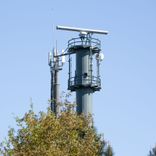
- Data fusion & precision tracking
Combining data from distributed sensors – radar tracking, AIS, CCTV/EOS, and radio positioning signals from Time Difference of Arrival (TDoA) receivers – to accurately localise and track multiple targets, assist with identification, and predict their future movement with meter-level precision.
- Predictive path forecasting
Continuous vector analysis anticipates vessel trajectories, offering early warnings by simulating potential intersections or zone breaches – helping you plan interdictions or evasive manoeuvres in advance.
- Adaptive sensor control
The system continuously evaluates situational risk in real time, automatically adjusting sensor tasking, coverage, and focus – ensuring high-priority zones and verified targets are continuously tracked, while supporting simultaneous operations across the entire area of interest.
- Historical playback
Full traffic recording, indexing, and replay functionality allow operators to review sequences of events – perfect for after‑action reviews or incident investigations.
- Resilient performance & high availability
Provision of customisable real-time notifications and alerts to operators for managing vessel traffic, preventing collisions, and mitigating risks to ensure maritime safety.
- Collaborative tasking & data sharing
Supports secure, real-time data sharing and collaborative tasking between agencies – enhancing coordination, accelerating response, and maximising shared situational awareness.
- Data transmission & multi-layered operator stations
The system ensures reliable and secure data transmission through multi-redundant channels, with real-time analysis and visualisation tools accessible across multi-layered operator stations for mission-specific operations.
- Mission management
An integrated feature enabling real-time coordination between the Command Center and field units. It fuses live data, communications, and tasking tools to ensure clear mission oversight and dynamic updates, keeping all units aligned, informed, and ready to respond to evolving situations.
Optional components
- Radio communication systems
VoIP‑based MH/HF, VHF/UHF modules, DSC/NAVTEX integration, telephone calls, call logging, and encrypted voice channels – delivering secure, redundant voice and data comms in any weather.
- Meteorological & hydrographic sensors
Weather stations, tide gauges, wave sensors, and oli spill sensors feed real‑time environmental metrics directly into the COP.
- CCTV & PTZ cameras
Ultra‑HD optical feeds with remote pan/tilt/zoom control and intelligent video analytics for recognition, behaviour analysis, and fence‑line intrusion detection.
- Digital selective calling (DSC) & NAVTEX
Automated safety broadcasts, navigational warnings, and maritime safety information delivered straight to operator equipment.
- AI‑driven analytics toolkit
An optional module that applies advanced algorithms for pattern recognition, anomaly clustering, and predictive risk scoring – enabling faster, more informed decisions and delivering deeper insights into maritime behaviour.
- Mobile & portable units
Rapid‑deploy trailers and drone‑mounted sensor pods for temporary operations or emergency response scenarios.
- Analytics & reporting module
On‑demand and scheduled reports, customisable KPIs, and historical trends analysis – enabling decision makers to review past events, refine rulesets, and continuously improve operational effectiveness.